How is the Bettendorf Police Department Utilizing OSCR360?
Sergeant Andrew Champion of the Bettendorf Police Department reached out to L-Tron in March of 2019 – he was originally looking for a tool that could help him open roads up faster after crashes. After meeting OSCR, he realized the system could be used for so much more. How is the department utilizing OSCR360 now?


About the Bettendorf Police Department:
Bettendorf Police Department is an agency located in eastern Iowa, almost on the border of Illinois. The philosophy of the department is to stay “focused on community-oriented policing and establish relationships in the community with citizens, community leaders, schools, youth, social service providers, and other law enforcement agencies at the local, county, state and federal levels” (bettenorf.org).
The agency is currently led by Chief Keith Kimball, and consists of two major divisions – the support services division and the field services division. On average, the department receives roughly 65,000 incoming calls each year through their dispatch center. The department is 45 sworn-officers strong, with many additional civilian employees – all working together toward the common goals of community safety, protecting & serving their 35,000 residents.
What attracted the department to OSCR360?
When the Bettendorf PD was first introduced to OSCR, they were interested in using the system on major crashes. At the time, whenever there was a major scene or fatal crash, they would reach out to the neighboring department, Davenport, to borrow their FARO. Bettendorf’s traffic unit, however, was not a fan of the complicated software and wanted something they could use more easily. The traffic unit was still pulling tapes for all of their measurements and saw OSCR as a powerful, visual tool to complement their current processes.
Where are they now?
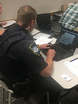
Since purchasing their OSCR system at the end of July, and completing OSCR training in early September, Bettendorf has brought the system to countless scenes.
Some uses include:
- The documentation of a suicide scene.
- Assisting the Sheriff’s department with a homicide scene.
- Several minor and major car crashes.
- Capturing the interior of cars.
- Creating pre-plans of all their schools/city buildings.
Sergeant Andrew Champion is pleased with how OSCR has performed so far. One memorable incident for him was documenting a serious injury by reckless driver scene. This particular crash involved a large construction zone. The department used OSCR to capture images every 25 yards – beginning before the construction zone started, and documenting all of the signage leading up to the crash. If this case were to go to trial, the OSCR software demonstrates that the driver ignored the speed signs, warning signs and arrow boards leading into and through the length of the construction zone.
“The goal is always to NOT go to trial,” says Champion. “This involves making sure you have all the proper prep work, proper paperwork and proper documentation. If you do have to go to trial, OSCR gives someone perspective – especially for vehicle damage or a crash spread over a large area – that a jury never would have had.”
-Sergeant Andrew Champion, Bettendorf Police Department, IA
How else is OSCR assisting the department?
Sergeant Champion states that Bettendorf has essentially moved away from laser mapping, and has had huge success in pairing drones with OSCR to document all of their major outdoor scenes. These two pieces of technology work hand-in-hand. The department drones take a 2-3 minute flight video, creating a 3D map, while OSCR is used in conjunction to capture 360 images and document vehicle damage. There are always blank spots missing during the scan – the drones are a powerful tool for forensics but do not paint the complete picture – like a photograph. Sometimes, conditions or time of day dictate that the drones cannot fly. “The good thing about OSCR is that I can use it day, night, whenever –that’s what really sets it apart,” states Sergeant Champion. Whether the department can measure the scene or not, they can always mark points and come back the next day to document further.
Champion goes on to share, “We had a significant collision on four lane road. The extended tripod/mast with OSCR saved the day the following morning when we came back to measure the scene. Not only did it photograph the marks we had already seen the previous day but it actually exposed some marks that had not been readily visible to us. These marks will be crucial in showing the rotation of the vehicles and collaborating CDR data. Due to power lines and the need to keep traffic moving a drone would not have even been an option.”
The department is continuing to find new ways to use OSCR and to share the technology with others. Champion is excited to see what else the system can do. “I’ve started using the OSCR mast to show skid and tire marks, and documenting crush damage.”
Interested in learning more about using OSCR for crash investigations & reconstruction?
Visit the OSCR360 crash page or contact L-Tron to get in touch with one of our current users. Email: info@L-tron.com or call: 585-383-0050.